world best travel places

Monday, November 28, 2011

The Agricultural Academy of Incas


This man-made monument may be found on the outskirts of Maras city that is situated in the holy valley of the Incas. It has 4 terraces and resembles an amphitheatre. But it's not a construction for public spectacles but some kind of an agricultural center-academy of the Incaic Empire.   The seed grown here, as researches believe, were sent by the Incas to various districts for harvest improvement. 
The largest terrace is the central one - it is 40-45 meters deep and each level is 2 meters lower than a previous one. It provides temperature gradient for some degrees. On the top, at the edge of the terrace, it is quite cool, about +15C, but in the lower part it's already about +30C. So, no wonder, Incas could have grapes and other tropical fruit on a table...

Sparkling Petrified World


Some photos from a small annual fair - "Petrified World" (German: Die versteinerte Welt 2011). 40 participants brought their collections of stones, minerals, jewels, jewellery. The event was held in the south of Berlin, in the district called Gropiusstadt.

Beit Baws - Abandoned Jewish Village


An abandoned Jewish village Beit Baws (or Bait Baws) is situated almost on the territory of the Yemen capital - Sanaa. In fact it looks abandoned only from the outside: some families do live here. They even managed to install electricity here.

Butterflies Park In Canada


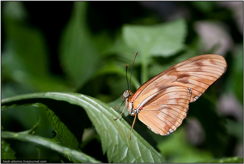
Cambridge Butterfly Conservatory is a part of heaven on earth located in Canada.The private company is not dependent on the state and prosper using revenue from sales of tickets, gifts and rolls in the local cafe. Under the roof of the butterfly park thousands of various butterflies, tropical plants, birds and spiders from different parts of our planet are collected.

The Celestial Empire From Above


Sitting at the window in a plane is a good idea as you see. Another proof how wonderful our planet is, how many beautiful pieces like these it consists of.
This is how China looks from above, to be more precise, its smallest part, from the height of 1000-10000 meters.
The route of flying:
1. Moscow - Beijing
2. Beijing - Xian
3. Xian - Chengdu
4. Chengdu - Lhasa
5. Xining - Beijing
6. Beijing - Moscow
Tibetan Plateau has been shot too, but its highest part though, the Huang He river and other natural, geological and dwelling objects are on the photos.
The Hung He river is also called the Yellow river due to abundance of alluvia making the river yellowish. They are also the reason why the sea where the river flows into is called Yellow. The basin of the Huang He is considered to be the place of the Chinese ethnos formation.
To various data the length of the river is from 4670 km to 5464 km, its basin's area - from 745 thousand km² to 771 thousand km².
The Earth is so wonderful and still unknown and life is not enough to know it...

Touching Ancient Delphi


On the slope of Parnassus mountain, not far from the Gulf of Corinth in Greece, there are ruins of an ancient city Delphi. First of all it is known for Delphian games that used to be held here. They were second popular after Olympic ones.  According to legend it is Delphi that was considered to be the center of the world created by Zeus. It's the motherland of Apollo, and the place where the hub of the universe is situated.
April in Greece is a wonderful time - everything is in bloom, ease and serenity are in the air. It's not even hard to climb mountains. 
Parnas
Lower part of the city
The upper part of the city. According to the legend - the hub of the universe is somewhere here.
Awesome views begin here.
Stone gallery has been well restored.
In the beginning of April there are not only flowers here but berries too.
General view of the ruins.
Amphitheater where musical competitions used to be held.
Stadium in the upper part of the city.
It's very beautiful here, probably as many centuries ago.

Northern Cyprus and Its Ghost City


The Turkish Republic of Northern Cyprus (or simply Northern Cyprus or North Cyprus) is a proclaimed in 1983, partially recognized state, occupying the northern third of Cyprus. Its population is approximately 200.000 people and the area is 3.355 sq. km. Northern Cyprus is separated from the rest part of Cyprus with a buffer zone. The line dividing the island into two sectors (the so-called "Green Line") is protected by the troops of the Armed Forces of the United Nations. 
The picture depicts the administrative division of the Turkish Republic of Northern Cyprus (red), the Republic of Cyprus (blue), the UK military bases of Akrotiri and Dhekelia (dark blue) and the buffer security zone (light blue).
The environs of Kyrenia. The monument to Attila Operations (the entry of Turkish troops into Cyprus in 1974).
The monument is installed on the coast, a few miles far from Kyrenia.
And on the opposite side are only mountains and clouds...
Here you can often see the flags of Turkey and the Turkish Republic of Northern Cyprus demonstrating the ownership of these territories.
The nature of these places is very beautiful.
The north of Cyprus has magnificent beaches.
The architecture is quite monotonous. A mixture of the buildings of southern Cyprus and the Turkish style.
Many restaurants and cafes.
These are the residential areas of Famagusta city. The adjacent to them quarter is called Varosha and otherwise known as a "ghost city". Let us tell you why.
In 1970 Famagusta was a major tourist destination in Cyprus. In view of the increasing number of tourists there were built many new hotels and tourist sites (the greater part of them appeared in Varosha). From 1970 to 1974 the city was at the peak of its popularity. It was visited by many famous personages of that time. such as Elizabeth Taylor, Richard Burton, Raquel Welch and Brigitte Bardot. 
But on July 20, 1974 the Turkish army invaded Cyprus (in response to the political upheaval in the country), and on August 15 of the same year occupied Famagusta. As a result, the country was split into two parts: Greek and Turkish. Living in Varosha Greeks were evacuated and since then have been prohibited to return (as well as whatever journalists). In this way, the quarter was frozen in time, with shops filled with clothes being fashionable 35 years ago, and empty but fully equipped hotels.
Since no repairs had been made over the long time, all buildings gradually became destroyed. The metal rusted, and numerous trees and other plants filled the streets...
It is surrounded only by such a fence with prohibiting billboards hanging on it.
The beach of Famagusta is the best in Cyprus - with fine sand and clear water. But, as you see, the beach is not crowded.
Photographing is forbidden here. The guards in the towers control all your movements.
Though, in some places the fence is low, and nobody is around. But we don't advise you to get there as, firstly, the territory of Varosha is still mined here and there and, secondly, the soldiers guarding the "city" are very determined. Seeing the offender, they won't probably comply with political correctness and diplomacy. Consequences can be extremely serious.
Varosha creates a sombre impression. The spirit of hopelessness hovers in the air and spreads all over Famagusta. The complete opposite of Kyrenia...
To change the mood, let's visit the main attraction of Famagusta, the Cathedral of St. Nicholas.
It's the main cathedral of the medieval city of Famagusta located on the eastern coast of Cyprus. It was built on the model of Reims Cathedral by Cypriot kings of the dynasty of Lusignan in the 14th century. The tourist brochures call it "the Cypriot Reims".
The cathedral was consecrated in 1328. Considerable damage to the building was caused by frequent earthquakes. In 1954 it was renamed the Lala Mustafa Pasha Mosque in honor of the captain who commanded the siege of Famagusta in 1571.